Browse "Parks & Nature Reserves"
-
List
30 National Parks Bigger than 30 Countries
To celebrate its 30th anniversary, The Canadian Encyclopedia created 30 lists of 30 things that make us proud to be Canadian, from famous people and historic events, to iconic foods and influential artists.
"https://d2ttikhf7xbzbs.cloudfront.net/media/media/a7c708ef-3e7b-4890-a1ad-f637397985a6.jpg" // resources/views/front/categories/view.blade.php
https://d2ttikhf7xbzbs.cloudfront.net/media/media/a7c708ef-3e7b-4890-a1ad-f637397985a6.jpg
-
Article
Algonquin Provincial Park
The oldest provincial park in Ontario and the first provincial park in Canada, Algonquin Provincial Park (established 27 May 1893, 7,625 km2) is located 250 km north of Toronto. The park is well known for its beauty, especially its numerous lakes and spectacular fall colours. It was a source of inspiration to members of the Group of Seven, especially Tom Thomson.
"https://d2ttikhf7xbzbs.cloudfront.net/algonquinprovincialpark/Wetland.jpg" // resources/views/front/categories/view.blade.php
https://d2ttikhf7xbzbs.cloudfront.net/algonquinprovincialpark/Wetland.jpg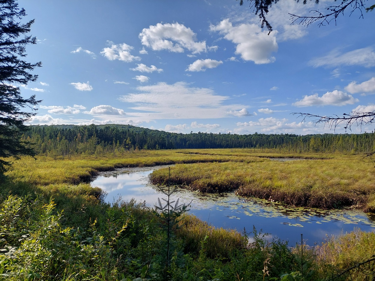
-
Article
Aulavik National Park
Centred on the wide Thomsen River valley on Banks Island, Aulavik National Park (set aside 1992, 12 200 km2) has an Inuvialuktun name that means "where people travel." The name was suggested by one of the elders of Sachs Harbour, the only community on the island.
"https://d2ttikhf7xbzbs.cloudfront.net/media/media/2303927f-a9a7-4140-b49b-6d17f8e0dbc2.jpg" // resources/views/front/categories/view.blade.php
https://d2ttikhf7xbzbs.cloudfront.net/media/media/2303927f-a9a7-4140-b49b-6d17f8e0dbc2.jpg
-
Article
Auyuittuq National Park
Located on the Cumberland Peninsula of Baffin Island, Nunavut, Auyuittuq National Park (established 2001, 19 089 km2) was Canada's first national park located north of the Arctic Circle. It was first set up as a national park reserve in 1976 and established as a national park through the Nunavut Land Claims Agreement.
"https://d2ttikhf7xbzbs.cloudfront.net/media/media/a4b74f70-c61f-4cfe-a857-0848e3cb40bd.jpg" // resources/views/front/categories/view.blade.php
https://d2ttikhf7xbzbs.cloudfront.net/media/media/a4b74f70-c61f-4cfe-a857-0848e3cb40bd.jpg
-
Article
Banff National Park
Banff National Park (established 1885, 6,641 km2) is Canada's first and most visited National Park.
"https://d2ttikhf7xbzbs.cloudfront.net/media/media/0e212945-05a3-448a-a593-1967884c7fd2.jpg" // resources/views/front/categories/view.blade.php
https://d2ttikhf7xbzbs.cloudfront.net/media/media/0e212945-05a3-448a-a593-1967884c7fd2.jpg
-
Article
Barachois Pond Provincial Park
One of the largest of 48 parks in Newfoundland and Labrador, Barachois Pond Provincial Park (established 1962, 35 km2), is located at the head of St George's Bay, 70 km south of Corner Brook along the Trans-Canada Highway.
"https://development.thecanadianencyclopedia.ca/images/tce_placeholder.jpg?v=e9dca980c9bdb3aa11e832e7ea94f5d9" // resources/views/front/categories/view.blade.php
https://development.thecanadianencyclopedia.ca/images/tce_placeholder.jpg?v=e9dca980c9bdb3aa11e832e7ea94f5d9
-
Article
Bruce Peninsula National Park
Bruce Peninsula National Park (established 1987, 156 km2) consists of a former provincial park and private lands acquired on a "willing buyer-willing seller" basis. Over 75% of the total area of the park has been acquired.
"https://d2ttikhf7xbzbs.cloudfront.net/media/media/1830aced-8e1d-4a0f-a01f-a06730153d28.jpg" // resources/views/front/categories/view.blade.php
https://d2ttikhf7xbzbs.cloudfront.net/media/media/1830aced-8e1d-4a0f-a01f-a06730153d28.jpg
-
Article
Butter Pot Provincial Park
Located on the Avalon Peninsula, Butter Pot Provincial Park (established 1958, 2833 ha) is 36 km southwest of St John's, Newfoundland, along the Trans-Canada Highway.
"https://development.thecanadianencyclopedia.ca/images/tce_placeholder.jpg?v=e9dca980c9bdb3aa11e832e7ea94f5d9" // resources/views/front/categories/view.blade.php
https://development.thecanadianencyclopedia.ca/images/tce_placeholder.jpg?v=e9dca980c9bdb3aa11e832e7ea94f5d9
-
Article
List of Canada's National Parks and National Park Reserves
Canada's National Parks and National Park Reserves National Park/Reserve Province Year Est Park Area sq km 1) Banff National Park Alta 1885 6641 2) Glacier National Park BC 1886 1349.3 3) Yoho National Park BC 1886 1313.1 4) Waterton Lakes National Park Alta 1895 505 5) Jasper National Park Alta 1907 10 878 6) Elk Island National Park Alta 1913 194 7) Mount Revelstoke National Park BC 1914 259.7 8) St Lawrence Islands National Park...
"https://development.thecanadianencyclopedia.ca/images/tce_placeholder.jpg?v=e9dca980c9bdb3aa11e832e7ea94f5d9" // resources/views/front/categories/view.blade.php
https://development.thecanadianencyclopedia.ca/images/tce_placeholder.jpg?v=e9dca980c9bdb3aa11e832e7ea94f5d9
-
Article
Cape Breton Highlands National Park
Cape Breton Highlands National Park (established 1936) stretches across the northern tip of Cape Breton Island.
"https://d2ttikhf7xbzbs.cloudfront.net/media/media/03df061a-6884-4196-9c78-be89627fa629.jpg" // resources/views/front/categories/view.blade.php
https://d2ttikhf7xbzbs.cloudfront.net/media/media/03df061a-6884-4196-9c78-be89627fa629.jpg
-
Article
Kinngait
Kinngait (Cape Dorset), Nunavut, incorporated as a hamlet in 1982, population 1,441 (2016 census), 1,363 (2011 census). The hamlet of Kinngait is situated on Dorset Island, off the southeast coast of the Foxe Peninsula of Baffin Island, 395 km southwest of Iqaluit. Known for a period as Cape Dorset, in 2020 the hamlet returned to its original Inuktut name, Kinngait, meaning “mountains.”
"https://development.thecanadianencyclopedia.ca/images/tce_placeholder.jpg?v=e9dca980c9bdb3aa11e832e7ea94f5d9" // resources/views/front/categories/view.blade.php
https://development.thecanadianencyclopedia.ca/images/tce_placeholder.jpg?v=e9dca980c9bdb3aa11e832e7ea94f5d9
-
Article
Cape Scott Provincial Park
Cape Scott Provincial Park (established 1973, 50 km2), on the northwest tip of VANCOUVER I, BC, includes 64 km of coast with 23 km of sandy beaches interspersed by rocky headlands. The land rises inland to Mount St Patrick (415 m), and in it lies a 44 ha body of freshwater, Eric Lake.
"https://development.thecanadianencyclopedia.ca/images/tce_placeholder.jpg?v=e9dca980c9bdb3aa11e832e7ea94f5d9" // resources/views/front/categories/view.blade.php
https://development.thecanadianencyclopedia.ca/images/tce_placeholder.jpg?v=e9dca980c9bdb3aa11e832e7ea94f5d9
-
Article
Cedar Dunes Provincial Park
Tucked into the westernmost corner of Prince Edward Island, Cedar Dunes Provincial Park (established 1962, 37 ha) has been developed around an historic lighthouse. Known as West Point, the site is the result of centuries of accretion of sand from a north to south coastal current.
"https://development.thecanadianencyclopedia.ca/images/tce_placeholder.jpg?v=e9dca980c9bdb3aa11e832e7ea94f5d9" // resources/views/front/categories/view.blade.php
https://development.thecanadianencyclopedia.ca/images/tce_placeholder.jpg?v=e9dca980c9bdb3aa11e832e7ea94f5d9
-
Article
City Parks
The period of intense park building (1880-1914) was stimulated by an interplay of 4 factors. The first was a belief that the city dweller's increasing separation from nature caused physical, mental and moral distress. Parks were seen as healing antidotes to this urban malaise.
"https://d2ttikhf7xbzbs.cloudfront.net/media/media/bcb1b4bb-e360-49d1-832f-a77992190b08.jpg" // resources/views/front/categories/view.blade.php
https://d2ttikhf7xbzbs.cloudfront.net/media/media/bcb1b4bb-e360-49d1-832f-a77992190b08.jpg
-
Article
Dinosaur Provincial Park
Dinosaur Provincial Park (established 1955, 70 km2) lies along the Red Deer River in southeastern Alberta. The park is the primary fossil site of the more than 100 different species of dinosaurs found in Canada. In 1979, the park was declared a United Nations World Heritage Site. (See also Dinosaurs and Canada.)
"https://d2ttikhf7xbzbs.cloudfront.net/media/media/e8e23bed-66e7-4173-9e92-b61c0b06e940.jpg" // resources/views/front/categories/view.blade.php
https://d2ttikhf7xbzbs.cloudfront.net/media/media/e8e23bed-66e7-4173-9e92-b61c0b06e940.jpg